LANDSCAPE STUDY: THE CULTURAL ELEMENTS
Copyright: Liz Forrest© 2006
LIST OF ILLUSTRATIONS
-
-
Bruachaig from the north (centre of the picture) .............................. p 5
-
Carved stone ball found at Bruachaig .................................................... p 6
-
Hut Circle Platforms ................................................................................. p 6
-
Cairns .......................................................................................................... p 7
-
Tobar Mhoire .............................................................................................. p 8
-
Eilean a’Ghobhainn Graveyard ............................................................... p 9
-
The Original Culaneilean Farmhouse ..................................................... p 10
-
The Present Farmhouse at Culaneilean .................................................. p 10
-
Old Sheep Fank ........................................................................................... p 11
-
Estate Map 1845 .......................................................................................... p 11
-
The Remains of Incheril Limekiln .......................................................... p 12
-
Kinlochewe Lodge from Incheril ........................................................... p 13
-
Incheril Lodge ............................................................................................ p 14
-
The Kennels, Tyavard, Incheril ............................................................... p 14
-
The Old Post Office .................................................................................... p 15
-
1881 Ordnance Survey Map ................................................................... p 15
The area chosen for study is roughly the kilometre square NH0362 situated at the southeastern end of Loch Maree to the north of the village of Kinlochewe. The area is rich in prehistoric sites with elements belonging to both early historic and historic times.
This brief report outlines the main sites together with a description and also any source references available.
One of the best documented sites is a short cist burial at Bruachaig, on improved pasture land within a bend in the Abhainn Bruachaig at the eastern margin of the area. In the Proc. Soc. Antiq. Scot. Volume 97 (1963-4) the discovery is described as follows:
“Found in July 1898 in a cist about 2 yards out from the door of the wool store at Bruachaig, Kinlochewe. The cist was about 4 ft in length and 2ft wide. The cist was covered by two flags which were on the surface level of the ground. A small opening between the flags drew attention to a hollow beneath and caused the flags to be raised. The earthenware jar contained nothing but a little loose earth.”
In the 1960s the “wool store” was the byre of Bruachaig, nothing now remains of the old buildings and a modern agricultural shed stands on the site. 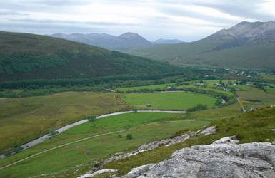
Figure 2: Bruachaig, from the north (centre of picture)
The beaker within the cist was loaned to the National Museum of Antiquities by Mrs MacKenzie of Gairloch and is illustrated below. It is described as being 6ins high, 5.5ins across the mouth and 3.4ins across the base. The decoration is a combination of incised lines and grooves around the neck with the lower part of the beaker having chevrons and herringbone patterns stamped onto panels. This beaker type has affinities with those found at Rudh a’Dunain, Skye and Blackstand on the Black Isle, rather than with beakers found at nearby Poolewe and Achnasheen. Associated with this cist a carved stone ball was found, now housed in the Gairloch Heritage Museum. These balls are uncommon from the west and are more common in the northeast Scotland of.
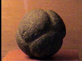
Figure 3: Carved Stone Ball found at Bruachaig
J H Dixon, writing his account of “Gairloch and Guide to Loch Maree” states “I am told an ancient burial-place was discovered some years ago at Bruachaig, Kinlochewe, where the bodies had been buried in a doubled-up position, the well-known custom in remote times.” Dixon was writing in 1886 so, it seems that there have been several cist burials in this small area with both inhumations and cremated remains.
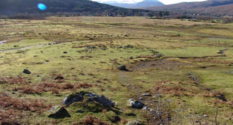
Figure 4: Hut circle Platforms
The next group of sites is located at the foot of the steep slope of Creag Ruadh in the northeastern sector of the study area. Two hut circle platforms can be seem in the previous photograph associated with a line of cairns along the break of slope as seen below
.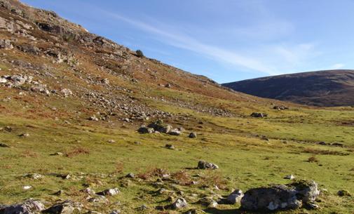
Figure 5: Cairns (first one centre, the next to the right and the third beyond)
On the northern edge of the study area is a holy well known as Tobar Mhoire which has been variously translated as “Mary’s Well”, or the “Well to the god Mourie” or possibly of St Maelrubha. This is a natural spring with a three-slab stone setting around it. Coins have been found within the well during periodic cleaning of the site. The spring feeds into a field boundary ditch and is on the downslope side of the course of the old military road from Dingwall to Poolewe. It is thought that this spring was part of the Pre-Christian spiritual landscape of this area, subsequently overlain with Christian symbolism from the time of St Maelrubha of Applecross, who was also associated with nearby Isle Maree within Loch Maree and where there is another holy well. Many Pre-Christian sites in Scotland are associated with water and many of the oldest place-names are those of rivers and consist of pre-Celtic and pre-Pictish elements.
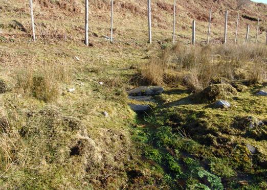
Figure 6: Tobar Mhoire
The sacred landscape of the area continues with sites associated with graveyards and possible church or chapel sites. The present graveyard was established in the first half of the 20th century. It is located on an area of raised ground to the northeast of Culaneilan Farm. This replaced an earlier graveyard situated at Eilean a’Ghobhainn, on the western margin of the present study area and named after the smith who was the first to be interred at this site around the latter part of the 17th century. This, in turn, replaced an earlier graveyard which was situated in what is now the centre of Kinlochewe village. This earliest site was abandoned when river erosion began to encroach on the burials.
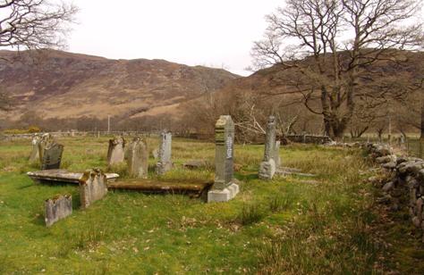
Figure 7: Eilean a'Ghobhainn Graveyard
On Blau’s map of 1662 “Heglis Loch Ew” is mentioned. Dixon mentions this in his account ….“ some remains of a house outside the burial ground are called “the chapel”; it may have occupied the site of an ancient church. ” Outside the boundary wall of the graveyard at Eilean a’Ghobhainn there is a pile of rubble which could represent “the chapel”. On the RCAHMS database this “chapel” is assumed to be the remains of a building which occurs outside the boundary of the current burial ground. The farmer at Culaneilean, who is 3rd generation at this farm, says that these are the remains of the original Culaneilean farmhouse which was abandoned in the 1880s when the present farmhouse was constructed.
The course of the Military Road from the east to Poolewe runs through the study area and can be seen above the fence-line in Figure 6, as a marked break in the natural slope.
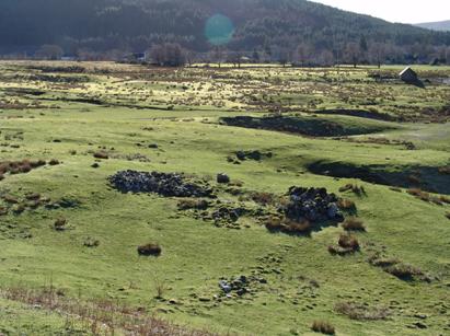 Figure 8 : The original Culaneilean Farmhouse Figure 8 : The original Culaneilean Farmhouse |
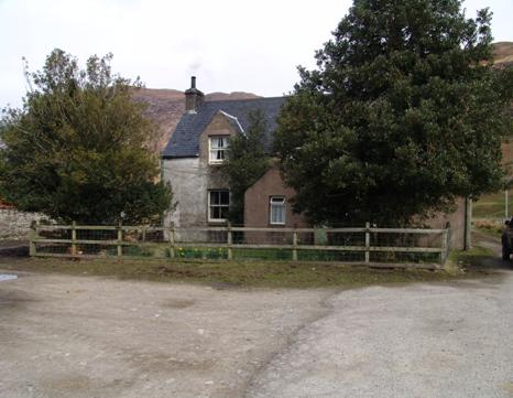
Figure 9: The Present Farmhouse at Culaneilean
|
|---|
.
Several sites within the study area can be traced back to the time of agricultural improvements of Gairloch Estates around 1845 when new crofts were laid out, however sheep were first introduced to the area around 1805 and sheep fanks began to be built like this one just to the north of the present graveyard. The flat strip of ground in front being the course of the 18th century road from Dingwall to Poolewe.
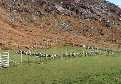 Figure 10 : Old Sheep Fank Figure 10 : Old Sheep Fank |
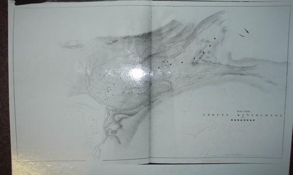 Figure 11: Estate Map 1845 (this is a laminated copy) Figure 11: Estate Map 1845 (this is a laminated copy) |
This estate map shows the layout of the new crofts and shelterbelt plantation alongside the road from Kinlochewe to Gairloch. The study area can be seen from Bruachaig, in the bend of the river on the eastern side of this map and Culaneilean towards the centre. (It is unfortunate that these copies of the original maps have been laminated for their conservation – this does not reproduce well by flash photograph.) Associated with these agricultural improvements, several limekilns were established within the study area, at Culaneilean, Blarmore and at Incheril. These are marked on the 1881 OS 1st Series and within living memory crofters would burn lime at Incheril for fertilising the land. Limestone is available locally from outcrops to the north and east of the study area.
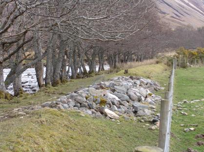
Figure 12: The remains of the Incheril limekiln built into flood defences.
In the 1840s also the value of the Sporting Estate was being realised and in 1842 this part of Gairloch Estate was formed into Kinlochewe Deer Forest. Although farmers and shepherds are still dominant in the Census Return for 1851, the first “gamekeepers” have appeared. These new ventures required new buildings and shooting lodges were built in Kinlochewe and Incheril, along with accommodation for gamekeepers and their dogs.
Figure 13 : Kinlochewe Lodge, from Incheril |
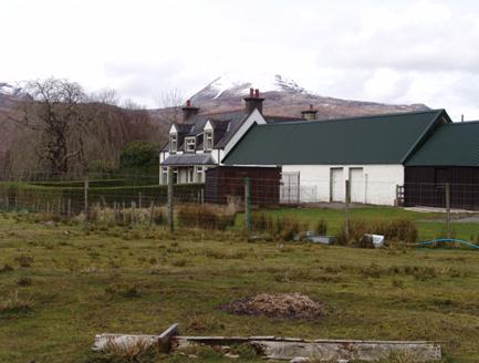
Figure 14 : Incheril Lodge |
|---|
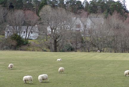
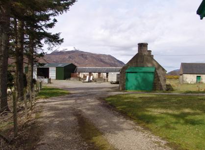
Figure 15: The Kennels, Tyvard, Incheril
The study area of this brief report also includes buildings associated with the social and cultural aspects of village life. The building marked on the 1881 Map as the Post Office is still in the same family.
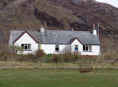
Figure 16: The Old Post Office
From even this brief overview of one square kilometre of Wester Ross it can be seen that thousands of years of human activity can still be recognised in the landscape.
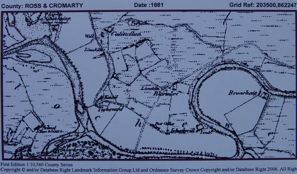
Figure 17: 1881 Ordnance Survey Map
BIBLIOGRAPHY
DIXON J H 1886 Gairloch and Guide to Loch Maree
HENSHALL A S & Three Beakers from Wester Ross
LONGWORTH I H 1966 Proc. Soc. Antiq. Scot. 97 (1963-4) 245
Census Data and Estate Records are kept in the Gairloch Heritage Museum.